This afternoon we drove a few minutes away from the town of Saint Catherine to climb Mount Sinai. Luckily for me, there was an ATM in the parking lot that actually had cash (it is Friday, and the other ATMs in town had no cash), so I was able to take out some Egyptian pounds, albeit only the maximum allowed, 3,500.
Anyway, we did not need any cash to climb the mountain, but you do need a guide and ours from the guesthouse navigated the security checks you have to do before you can proceed up the road towards the trail.
Once through security, you quickly reach the Saint Catherine monastery, but it is closed Fridays and Sundays, so we will visit it tomorrow morning before we leave Saint Catherine.
Just past the monastery the road ends and the trail begins. The trail begins at 1570 metres above sea level, and it is 4.85 kilometres to the summit, which is 2285 metres above sea level, so the gain is 715 metres. We started climbing just before 14:30.
Sunrise is the most popular time to climb Mount Sinai, but that involves climbing in the middle of the night and Diana and I would rather be sleeping in the middle of the night, so we were happy to be climbing for sunset. This also meant the mountain was mostly deserted. We passed a few people coming down, and we passed one family climbing up, but that was it. You can see in the photos how quiet it is.
There are several "coffee shops" on the way up, but they were mostly closed at this time of day. One was open, and our guide stopped to visit.
A dog followed us much of the way up, and there were cats in places, especially around the coffee shops. I don't especially care for feral cats, but I thought this was a pretty great photo opportunity.
We reached the summit just before 17:00, fifteen minutes before sunset.
There are a few spots on the summit worth commenting on. First, there is both a Christian chapel (the Church of the Holy Trinity and Cleft of the Rock, built in 1935), which was sadly locked . . .
. . . and a Muslim mosque (where our guide took the opportunity to say prayers), which apparently dates back to the 11th century.
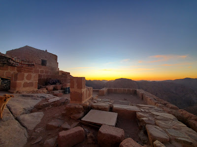
Both of these are built from ruins of prior churches, the earliest of which was built around 380 CE. To some extent you can see the footprint of what was a much larger church in this photo, and as you walk around the summit.
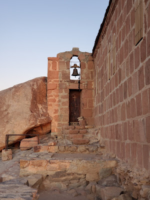
There are two caves at the summit, both associated with Moses (there is also a cave associated with Elijah on the mountain, but not at the summit). One of these is next to the chapel, through that door below the bell in the picture below. We could not go into this cave, and I am not sure how often it is open (I think the chapel is usually open, just closed today because it is Friday).
The other cave is really a "cleft in the rock," which is where it is said God hid Moses when Moses saw God's back. This cleft is under the mosque, directly below the window in the picture below (I actually do not have a photo of the cleft itself, but you can, and I did, go inside).
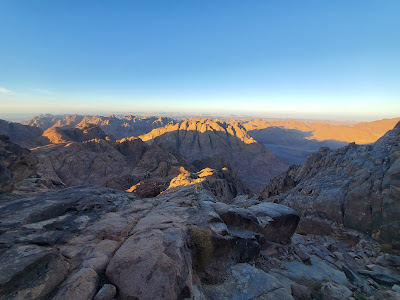
Besides taking in these spots, we enjoyed looking out over the incredible mountain/desert scenery . . .
. . . and, of course, watching the sun set.
Around 17:20, before we lost all daylight, we began our descent.
Diana and our guide are ahead of me here descending, and you can see there are some souvenir huts on a ledge down below them.
This Diana again, a bit further down . . .
. . . and our guide again, as well.
By 18:00 the daylight was long gone and the moon was bright, but still we had our cell phone flashlights out to light our way. Descending is much faster than climbing, not surprisingly, and it was a gorgeous, quiet evening. Our guide let us walk alone, either lagging behind or going significantly ahead, most of the way.


No comments:
Post a Comment